
Johnstone Strait to Desolation Sound – 2017
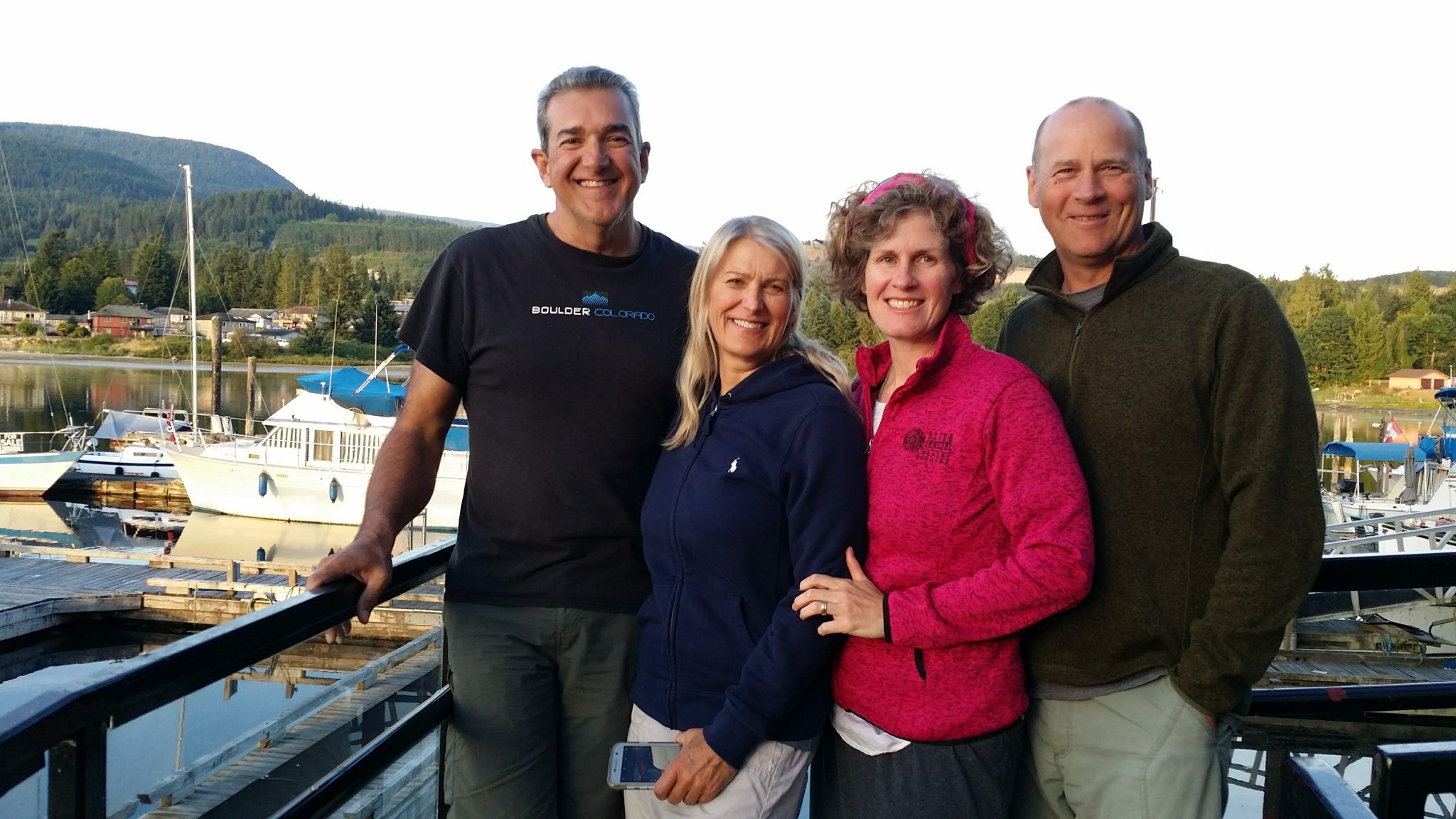
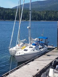
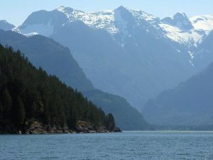
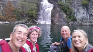
2017 was a year of relocating the Sailing School to Victoria. Along the way it’s hard not to have fun. Our friends Chris and Lydia joined us on this leg of our relocation from Port MacNeill to Desolation Sound. If you’ve never sailed this part of BC, we highly recommend it. Johnstone Strait is a deep and narrow glacier-carved passage located between the east coast of Vancouver Island and the British Columbia mainland. 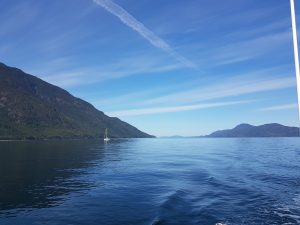 It serves as an important thoroughfare for marine vessels that include cargo freighters and cruise ships bound for Alaska in the summer months. Watch out for afternoon winds coming down the Strait caused by differential heating of air in the interior mountains. The Strait can really pick up in the afternoon heat. Considering that there is a fair tide that flows in and out of the channel, you can get a beneficial lift or a ugly wind against tide. Knowledge is key. The weather reports are fairly accurate and are updated regularly. The rule, as always, is leave your schedule at home, and move when the situation allows. Often this means moving before the heat of the day kicks up the inflow winds. If you’re willing to move when weather is optimal, then there is no need to fear the big waters of Johnstone Strait.
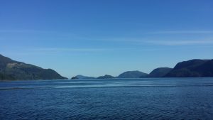
Johnstone Strait is home to the largest resident pod of killer whales in the world, with a population of somewhere between 150 and 250 whales. There are few better places to view these amazing marine mammals. In addition to the Orcas that can be viewed around Robson Bight, Johnstone Strait offers up a wide variety of other marine life, including Minke, Humpback and Grey whales. Pacific white sided dolphins, Harbour porpoises, Dall’s porpoises, Harbour seals and Steller’s sea lions. Bald eagles and an abundance of seabirds will also be encountered in the area. You never know what Johnstone Strait will serve up.
This year we started from Port MacNeill and headed down past Alert Bay towards Port Neville.
Port Neville is a bay, port and locality on the north side of Johnstone Strait, south of Call Inlet.
The locality of Port Neville, which has a old historic post office, is located on the east side of the narrows that form the opening into Johnstone Strait of the port, which is really an inlet.
It isn’t until you get to Port Neville, on the mainland side of Johnstone Strait and the next stop along the coast heading north from Kelsey Bay, that you realize why Norwegian settler Hans Hansen would have chosen this place to build a homestead. Not only does the 13- kilometre-long Port Neville inlet offer shelter from the winds and strong currents of Johnstone Strait, but it is pristine and beautiful.
“It isn’t until you get to Port Neville, that you realize why Norwegian settler Hans Hansen would have chosen this place to build a homestead. Today, a large government dock remains that boaters can easily access, and at the end of the dock, the sturdy old log Hansen home, built in 1920, still stands as a tribute to Hansen and his ingenuity. For more than a century, Port Neville was an important community on the coast and over the years operated as a fuel depot, post office, general store and gathering place.
The Port Neville post office was, in fact, the oldest continually operating post office in B.C., with Hansen’s granddaughter, Lorna Chesluk, being the last postmistress when it closed in 2010.”
*Borrowed respectfully from an article written by Catherine Gilbert for the Campbell River Mirror in 2013
If you’re very nice to the family there, you may be allowed to see some of the fascinating history that is Port Neville. The land is privately owned, so it’s not for the traveler to just wander around without an invitation. On one of our previous visits, we found a reference to our now, 101 year old grandfather, in a phone book dating back to early part of the 20th century. As it is with all the historical sites along our beautiful coast, the descendants of the Hansen’s are faced with the question of what to do with the place now as time moves forward and the ties to the historical sites fade.
From Port Neville we headed towards Blind Channel located between West and East Thurlow Island. This was our exit from Johnstone Strait and into the back channel access to Desolation Sound. The fiords in this area are spectacular.
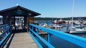
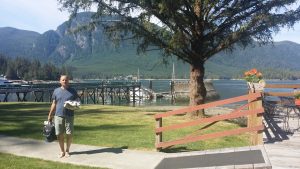
Blind Channel Resort is located conveniently in the narrows between West and East Thurlow islands. 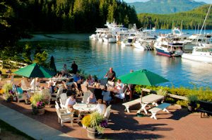 The marina at offers 2000 feet of sturdy dock space.
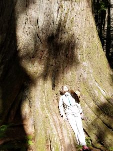
This includes seven widely-spaced 80 foot fingers, an aircraft dock, and a fuel dock. Clear UV-treated spring water is available from hose bibs along the docks and 15, 30 and 50 Amp power is available 24 hours a day. Marine fuel is available at Blind Channel. They carry marine marked diesel, mid-grade gas and oils. Pure, clean spring water is available all along the docks as well as on the fuel dock. No chemicals are added, but the water is UV treated to meet Health Canada’s requirements. We enjoyed the showers and the wonderful forest trails that lead away from the resort area. You will see Douglas fir, Hemlock, and Western Red Cedar trees that make the west coast famous. There is a Cedar there that predates European contact and the girls lovingly refer to it as the “Grandmother Tree”.
From East Thurlow Island its back channels to Desolation Sound. We didn’t experience much wind there, but you do have to be aware of the tidal currents. Its an interesting place for currents as not all the current flows are intuitive. You are getting to the part of the Marine world where the tidal influences from around the north part of Vancouver Island and the Southern part of Vancouver Island meet. Reading the charts is necessary and arriving at pinch points (where the current is increased) is essential. Fortunately, much like a manual, the charts are there for anyone who wishes, to read. The currents around Stuart Island were very impressive indeed and I would be remiss if I didn’t warn you to be on time.. “Time and Tide waits for no man”
Stuart Island:
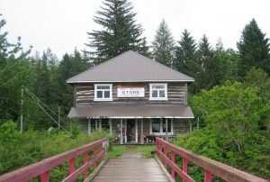
We stopped at the Stuart Island Community dock and general store for provisions. It was nice to get off the boats, and have the refreshing shower. Stuart Island is a hub for summer travelers and is a must stop for adventurers. There are several really good nature trails there, and it would be easy to spend a good amount of time visiting the place. For us it was a quick stop on our way through, but I look forward to going back and spending more time there. In fact, slowing down is the right way to enjoy Desolation Sound. We spent only an evening at Stuart Island while preparing for out trip down Bute Inlet.
Bute Inlet.
Note to self – don’t go down Bute Inlet without a plan.
 There are virtually no places to anchor in Bute Inlet that doesn’t require a firm puckering of the sphincter. If you go all the way to the end, there is anchoring at the head of the inlet. If not, there are very few places to stop. We thought we could just breeze on down to the Grizzly bear area at Holmalco. This was not a good idea. The Bay is exposed to wind and waves coming down the inlet and there is no docking facility for boats and dodgy holding ground for anchoring. No way you would want to spend an evening there in adverse conditions. I would advise booking a tour, or at least pre-planning with the locals. On the day we went, we had a hard wind coming down the inlet and didn’t have anywhere to ride it out, so we pounded back up the inlet to a place of refuge. Beautiful, but also harsh. First time is for learning, right?
Back to Stuart Island.
From Stuart Island we headed southeast to West Redona Island and Teakern Arm Provincial Park. The beautiful 128-hectare Teakerne Arm Provincial Park is located on Teakerne Arm off Lewis Channel on the west side of West Redonda Island.
The park features forested uplands and, the highlight for visitors, the 30-metre high Cassel Falls. Follow the hiking trails to Cassel Lake, perfect for a picnic and a swim in one of the best swimming spots on the Sunshine Coast. We didn’t go far enough to get to Cassel lake this time, but it is on the list for next. (again, slow down and smell the roses)
Most boaters anchor in the bay immediately to the west of the falls, with plenty of anchor rode out in the deep bay and a stern line fastened ashore. We anchored off to the east and found the place charming and peaceful. Having a stern tie option is essential for boating in Desolation Sound and really anywhere in the Southern Islands. Boat access to Teakerne Arm Provincial Park and Desolation Sound Marine Provincial Park is from Lund on the Sunshine Coast, or from Squirrel Cove on Cortes Island in the Discovery Islands.
Next, it is on towards Pendrell Sound. First stop Refuge Cove at the southern end of West Redonda Island.
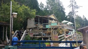
“Refuge Cove has long been a favourite stop of boaters cruising the coastal waters of British Columbia. Visitors to Refuge Cove will enjoy the charm and traditions of an historic coastal village alongside the convenience of an established supply stop.” We did enjoy are stop there. There is a nice little store, and coffee shop and cafe. It has all the things you need if you forgot or run out. It has all the services that a passing boater might need, including fuel and water. We were even able to offload our garbage to a fellow there who had a barge for that purpose.
From Refuge cove we were off to Pendrell Sound. 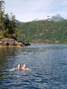
Pendrell Sound is surprisingly, the warmest salt water north of Mexico (27°C/82°F) awaits swimmers. Coming from the far North, the summer heat and pleasant evenings were really the delight of the trip. We are used to the powerful North Coast and by comparison Pendrell sound is the like moving to Mexico. I was told, but didn’t really believe, that you could swim in Pendrell sound without fear of cold shock that would accompany such folly in the North. Turns out, it’s true. The days were sunny and warm and the water inviting. Our trip was earlier in the July, so we were able to avoid the throngs of summer, but in early July the weather was already hot and the swimming cool.
Note to travelers.
The warm water and lack of strong tidal flow in and around Desolation Sound really does not lend itself to the purging of potty tanks. There are just too many people and too little big water for that to be ok. Before you head out to the area, be sure to have emptied your tanks completely and plan to bring the contents back to an appropriate waste disposal when you leave. The same goes for trash and anything that might be left behind.. If you brought it in, then take it out.

Hope you enjoyed this post. Join us for your next adventure.